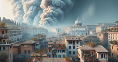
When frost arrives in Italy (and risk of snow)
Christmas will arrive a month early in Italy.
In fact, on November 25th, a mass of freezing air will arrive and envelop our peninsula, bringing with it winter temperatures.
From the Rovaniemi area in Finland, famous for being the birthplace of Santa Claus, a cold air current will arrive which will also hit Italy.
Passing through the Baltic Republics and Poland, the cold air current will reach the Mediterranean, causing a sudden drop in temperatures, bringing them below the average for the period, especially in the North where there could be several snowfalls.
However, not only the north of the peninsula will be at risk of snow, but also the Po Valley and some central cities.
Antonio Sanò, founder of Il Meteo.it warned that the drop in temperatures will also be accompanied by strong winds and some regions could be affected by showers.
With the cold upon us, it's best not to be caught unprepared: here's when and where the frost arrives and the risk of snow.
read also Boiler maintenance, how often it must be done and what risks those who don't do it When frost arrives in Italy: the forecast A mass of icy air coming from the Finnish Arctic Circle – from Finland – will cross the Baltic Republics, Poland for then descend on the Mediterranean, with the first “Attila's arctic saber strike” of the season and a very powerful one.
The frost will officially arrive on Saturday 25 November causing a drastic drop in temperatures.
This typically winter climate will last all next week with temperatures below average, so much so that the first snowfalls could occur in some regions of Northern and Central Italy.
Going into detail, starting from the evening of Friday 24 November, the Arctic air of Finnish origin will cross the Alps, blowing a strong Foehn wind in the Po Valley throughout the evening and also the following day.
But not only in the North, even in the Center there will be a sudden drop in temperatures while the skies will quickly become overcast between Lazio, Marche and Abruzzo Molise.
The South, however, will be the only area of Italy that could be affected by intense showers.
The Apennines are at risk of snow even below 1000 metres.
Wanting to go into detail and know the weather situation in the country for the whole weekend, according to the weather forecast: Saturday 25th.
In the North: strong Foehn winds, clouds and snow on the Border Alps, sunny elsewhere.
Center: windy; clouds and showers between Lazio and the Adriatic side, more sun elsewhere.
In the South there will be a worsening with widespread showers and snow at hilly altitudes, strong winds from the north.
Sunday 26.
In the North and Centre: clear but very cold at dawn, sometimes windy.
In the South: sunny but cold in the early morning and windy at times, some showers in Puglia.
Which cities are at risk of snow? With the cold, snow could also arrive, recalling that much-loved Christmas atmosphere.
But where could the first snowfalls be recorded? The first snow could arrive in Piedmont and the Po Valley on the night between Monday 27 and Tuesday 28 November with a possible repeat in the first days of December.
On the Lazio Apennines, especially on the Frosinone Apennines, the first snow could reach up to 500-800m.
However, the snow could also cover the capital with temperatures that will approach 0°C from November 27th, fulfilling the desire of many tourists to be able to see the whitewashed Colosseum.
Temperatures could drop to -1°C in the Roman countryside.
In short, from the anomalous summer heat, the result of the undeniable climate change, we will move on to the sudden freezing temperatures of Attila's Arctic Saber Strike.
read also Weather warnings, how and when floods occur


